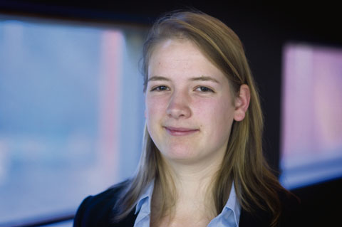
Bachelorstudent molecular science & technology Aletta Kaas (22) heeft met haar afstudeeronderzoek ‘Fuel out of water, light and rust’, de Shell Bachelor Prijs 2010 gewonnen.
Wil je de energieproblemen oplossen met roest?
“Met nanodraadjes van roest. Dit is ontzettend nieuw onderzoek. In de toekomst zijn er misschien wel grote velden met cellen waarin door middel van foto-elektrolyse water gesplitst wordt in waterstof en zuurstof, net zoals er nu velden zijn met zonnepanelen. Het roest dient in die cellen als katalysator.”
Hoe ben je hier op gekomen?
“In eerste instantie moest ik me voor mijn afstudeeronderzoek richten op een techniek met een andere katalysator, een techniek waarvan men dacht dat die meer kans van slagen zou hebben. Maar het leek mijn begeleider uiteindelijk een beter idee om een masterstudent op dat onderzoek te zetten omdat het zo veelbelovend leek.”
Dan heb je ze nu met het winnen van deze prijs goed teruggepakt.
Lacht. “Ja.”
Je hebt onder meer gewonnen vanwege je krachtige pitch.
“Ja, en dat terwijl ik presenteren niet zo geweldig vindt. Ik was nogal zenuwachtig. Maar dat schijnt gelukkig niet zo op te vallen.”
Wat zijn de trucs voor een goede pitch?
“Zorg dat je niet teveel ingaat op de techniek. Vertel wat je eraan hebt en wat jouw eigen bijdrage is. Dat zijn de tips die we kregen tijdens een pitch-training.”
Even geen pitch nu dan. Vertel eens over de techniek.
“Met een anodiseerproces met een zuur proberen we een poreuze mal van aluminium te maken waarin we de nanodraadjes van roest kunnen laten groeien. Die mal kun je later oplossen waardoor je alleen nanodraadjes overhoudt. Het probleem is dat het zuur ook een laagje geleidend glas aantast dat onder het aluminiumlaagje zit en dat later nodig is voor de foto-elektrolyse. Ik heb dit probleem opgelost door een bufferlaagje aan te brengen van wolfraam en titanium tussen het glas en het aluminium.”
Maar wat schieten we eigenlijk op met foto-elektrolyse cellen? Je kunt toch al op andere duurzame manieren waterstof produceren?
“Ja, dat klopt. Maar tegenwoordig heb je daar meerdere machines voor nodig. Je kunt bijvoorbeeld een elektrolysemachine aansluiten op zonnecellen. Onze productiemethode is veel simpeler. En we gebruiken geen schaarse materialen.”
Wat vind je het interessants aan jouw onderzoek?
“Ik vind het leuk om met duurzame energie bezig te zijn. En het is echt heel nieuw en fundamenteel onderzoek. Het kan overigens nog wel dertig jaar duren voordat foto-elektrolysecellen op de markt komen. We staan aan de wieg van de techniek.”
Ga je tijdens je master verder met dit onderwerp?
“Nee, ik wil verschillende dingen doen. Zonnecelonderzoek lijkt me ook leuk.”
Wat ga je met de vijfentwintighonderd euro doen die je hebt gewonnen?
“Ik zet het eerst op een spaarrekening. Misschien ga ik het gebruiken om met mijn vriend naar Istanbul te gaan.”
For geologists and earth observers the volcanic eruption in Iceland is a thrilling happening. And so it is for dr. Andy Hooper and professor Ramon Hanssen of the Aerospace Engineering faculty’s remote sensing department. “It’s fascinating. What we’re witnessing here is the separation of America and Europe”, says Hanssen, whose scientific fascination is of course tempered by the genuine fear and concern among the people of Iceland.
Fascinating is not the word that first comes to the minds of the Icelanders. That word would be ‘jokulhlaup’, which is a flood caused by sub-glacial volcanic
eruptions. Owing to the magma, the water under the ice sheet melts and this can lead to huge amounts of water suddenly being released. In 1996 a similar eruption lead to such a flood, which washed away large parts of the road that encircles the island. For some people, what used to be a short ride from point A to B became a two-day journey, as they had to drive around the island in the opposite direction.
Hooper is keeping a sharp eye on the developments in Iceland. Since 2006 he has studied the deformations of this area – the Eyjafjallajökull region – that is now worrying the Icelanders. Up to 2008 he worked at the University of Iceland. Now he works on that same topic in prof. Hanssen’s remote sensing group at TU Delft.
Hooper’s computer screen shows an image obtained by radar from satellites, in which blue, yellow, red and green dots indicate how strongly the area around the recently erupted Eyjafjallajökull volcano was uplifted over the past few months. In January and February the area rose in total by about three to four centimeters.
“You see, we did measure the seismic activity and deformations that lead to the eruption”, Hooper explains, “but these kinds of activities also occurred a couple of times during the 1990s and did not lead to eruptions. I hesitate to use the word, but we failed to predict the eruption. We still need to better understand the magmatic plumbing in the underground.”
But Hooper and his colleagues might soon get a second chance.
Not far from Eyjafjallajökull is the Katla volcano. And this second volcano is what really worries the Icelanders. “The two volcanoes are geologically linked”, Hooper says. “The eruption of one of them might trigger the other to erupt as well.” If the Katla erupts, it could have devastating consequences. The magma from Eyjafjallajökull surfaced at a spot that wasn’t covered with ice. The other volcano however is covered with a much bigger ice sheet, increasing the risk of a jokulhlaup flood.
The radar data with which Hooper created the colorful image showing the rise in the surface around Eyjafjallajökull in January and February were far from optimal. During the recent winter months most of the land was covered with layers of snow. Consequently, the radar waves could barely reach the ground, resulting in lots of background noise in the image. This week Hooper will receive the data from both volcanoes obtained by satellite the day before the eruption took place, and next week he will receive the data gathered a few days after the eruption. With these data sets he hopes to get a clearer picture of what is actually going on. There is less snow now, so this fact should benefit his research.
“But even with clear radar pictures, it’s a feat to understand the deformations”, Hooper warns. “In Iceland, many different things are happening. The tectonic plates are moving, there is volcanic activity, and there is postglacial rebound (the rise of the land in response to the retreat of ice caps). We have a couple of GPS stations just south of Katla that are moving southwards. And we cannot explain why.”


Comments are closed.